
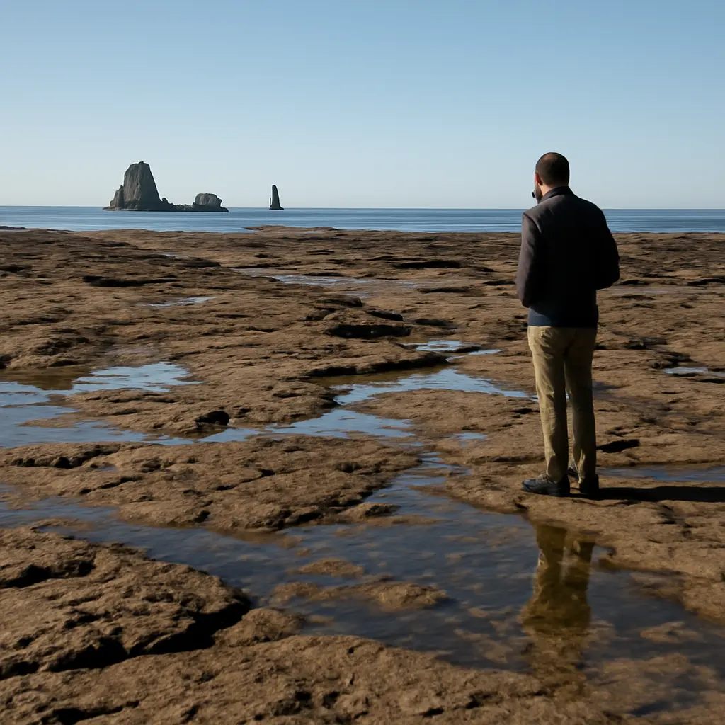
Tide timing is the difference between a rocky shoreline that looks sculpted and dramatic and one that appears flat, flooded, or visually ordinary. A tide is the regular rise and fall of sea level, driven mainly by the Moon’s and Sun’s gravitational forces; for rock photography and coastal viewing, the key is how that changing water level exposes ledges, pools, channels, and wave action. NOAA describes tides as long-period waves that move through the ocean in response to these forces. Because tidal range and timing vary by location and day, checking a local tide table—and matching it to the rock formations you want to see—can transform a visit. The sections below explain the tide-and-rock relationship, how different tide stages change the scene, how to plan safely, and what real coastal examples reveal.
Tide timing shapes the visual character of coastal rocks
Tide timing is the selection of a visit time according to the predicted local sea level, usually expressed as the time and height of high and low water. The National Oceanic and Atmospheric Administration (NOAA) defines tides through the periodic rise and fall of sea level, while its tide predictions provide the expected times and heights at specific stations. Those predictions matter because the same rock platform can be submerged at high tide, edged by breaking waves as the water falls, and fully exposed at low tide.
A tide’s visual effect depends on more than the clock. Local tidal range, shoreline shape, swell, wind, and the height of the rocks all influence what is visible. NOAA notes that many U.S. coastal locations experience two high tides and two low tides each lunar day, about 24 hours and 50 minutes, but the pattern varies: some places have one high and one low tide daily, while others have mixed patterns. Tidal range also differs substantially by region, so a “low tide” at one beach may uncover broad shelves while a low tide elsewhere exposes only a narrow strip.
Why exposed rock looks more dramatic
Exposure creates visual separation. At lower water levels, ridges, cracks, tide pools, and isolated boulders become easier to distinguish; shallow water can also reflect the sky and add contrast around dark rock. At higher water levels, water covers small-scale texture and may make the shore look smoother, while waves can emphasize a sea stack or cliff by breaking against it. The most striking moment is therefore not always the lowest tide: a falling or rising tide can combine visible rock detail with moving water.
The National Park Service’s coastal guidance emphasizes that tides and waves can change access to shoreline areas and that visitors should be aware of changing conditions. This is especially important around isolated rocks, narrow beaches, and headlands, where a route that is passable at low water can become cut off as the tide rises.
Tidal range and local shoreline geometry
Tidal range is the vertical difference between high and low water. A larger range can uncover more of a sloping rock platform, but the amount of visible rock also depends on the platform’s gradient and the shape of nearby coves. On a gently sloping shore, a modest vertical change can move the waterline a long distance; on a steep cliff, the same change may produce little additional exposed ground.
NOAA’s tide predictions are station-specific, which is why a nearby harbor’s times should not automatically be treated as exact for a different beach. Local geography can shift the timing and height of the tide. Check the prediction station used for the actual destination and consult local park or marine advisories for site-specific conditions.
Different tide stages reveal different rock features
Once the local tidal pattern is understood, the next decision is which stage best suits the intended view. Low, rising, high, and falling water each reveal a different combination of rock, reflection, and surf. These are practical categories rather than guarantees: swell and weather can alter the appearance dramatically, even when the predicted tide is the same.
Low tide: shelves, pools, and rock texture
Low tide is the stage most likely to expose broad rock platforms, channels, and tide pools. It is often useful for close views of texture or for seeing the base of formations that are underwater at other times. The National Oceanic and Atmospheric Administration’s tide tables list predicted low-water times and heights, but visitors should remember that actual water levels can differ because of weather, wind, and atmospheric pressure.
Low water does not mean no hazard. Waves can run farther inland than expected, and water may refill pools or channels quickly. Avoid crossing to offshore rocks unless a safe return route is clear and local guidance permits access.
Rising tide: reflective water and moving surf
A rising tide can provide a useful balance: some rock remains exposed while water advances into grooves and around isolated formations. The resulting reflections and wave movement can give a scene more depth than a completely drained platform. This stage may be especially effective for landscape photography, but it also steadily reduces the available shoreline, so visitors should know the route back before approaching the water.
High tide: sea stacks, cliffs, and wave impact
At high tide, low rock shelves and pools are submerged, but taller formations can appear more isolated against open water. In suitable swell, waves may break against cliffs or sea stacks, adding motion and scale. High tide is not inherently more dramatic: calm water may soften the scene, while rough seas can make exposed viewpoints dangerous. Keep well back from the edge and follow posted closures.
Falling tide: a changing shoreline
A falling tide gradually uncovers rock features and can create a sequence of changing compositions. It is useful when the goal is to watch pools, ledges, or channels emerge rather than arrive at a single static view. The visual opportunity comes with a planning trade-off: the best exposed-rock window may occur after the shoreline has already begun changing, so check both the tide time and the length of the walk.
Planning a safe and visually rewarding rock visit
A good tide plan combines prediction, local knowledge, and a realistic safety margin. Tide tables forecast astronomical tides, but they do not fully capture storm surge, wind-driven water, large swell, or sudden weather changes. NOAA advises users to treat predictions as guidance and consider actual conditions. For coastal walks, the National Park Service also recommends checking alerts and being aware that waves can reach farther up shore than expected.
Use the right tide information
Check a tide prediction for the closest relevant station, note the times and heights of both high and low water, and confirm the time zone. If the destination is remote or has unusual currents, consult local authorities, park staff, or harbor guidance rather than relying on a generic forecast. Leave enough time to return before rising water affects the route.
Account for waves, weather, and access
The predicted tide is only one part of the water level you experience. Strong onshore winds, low atmospheric pressure, and energetic swell can push water higher or farther inland than expected. Wet rock can be slippery, and algae-covered surfaces may be especially hazardous. Stay off wave-washed ledges, avoid turning your back on the sea, and do not enter restricted or unstable areas.
Match the visit to the purpose
For rock-pool detail, aim near low water while leaving a generous return margin. For reflections and partially exposed formations, consider the hours around a changing tide. For cliffs and sea stacks, high water may provide a cleaner waterline, provided surf and access conditions are safe. Photographers can also check sunrise or sunset times: light direction and cloud cover often determine whether exposed rock appears richly textured or visually flat.
A useful planning graphic would show tide height against time, with low and high water marked alongside sunrise, sunset, and the planned walking window. Such a chart makes clear that the best visual moment may be a short interval rather than the exact low-tide time.
Real-world examples show why local timing matters
Coastal landmarks illustrate how the same tide principle produces different results. At the Oregon coast’s Haystack Rock, lower water can reveal more of the surrounding intertidal area, while higher water emphasizes the sea stack rising from the surf. At California’s Point Reyes National Seashore, park guidance warns visitors to account for tides when exploring beaches and coastal routes. In both settings, the local forecast and access advice are more useful than assuming that a tide time from another shoreline applies.
These examples also show why dramatic appearance and safe access are not the same thing. A high-energy swell may make waves striking against rocks, but it can also create hazardous conditions. A quiet low tide may reveal intricate detail, yet a narrow exit route can become unsafe if the water returns. Choose the visit for both the view and the conditions.
Conclusion: timing turns a rocky shore into a changing landscape
Tide timing determines which rock features are visible, how water frames them, and whether the shoreline feels broad, reflective, or wave-swept. Low tide often reveals shelves and pools; rising and falling tides create changing patterns; and high tide can isolate taller formations against open water. But tidal range, shoreline shape, swell, wind, and light all influence the final scene.
Before your next coastal visit, check a location-specific tide prediction, review local access and safety guidance, and plan a return route with extra time. Treat the tide table as a forecast rather than a guarantee, and never trade a safe position for a more dramatic photograph. For further reading, consult NOAA tide predictions and the relevant national park or coastal authority’s current conditions.
Sources: National Oceanic and Atmospheric Administration, Tides and Water Levels, https://oceanservice.noaa.gov/education/tutorial_tides/; NOAA Tides and Currents, Tide Predictions, https://tidesandcurrents.noaa.gov/tide_predictions.html; National Park Service, Safety in the Coastal Environment, https://www.nps.gov/subjects/oceans/coastal-safety.htm; National Park Service, Point Reyes National Seashore, https://www.nps.gov/pore/index.htm; Oregon State Parks, Haystack Rock, https://stateparks.oregon.gov/index.cfm?do=park.profile&parkId=136.


